


The Lagebaracke, on July 20, 1944, after the attack
(picture: After the Battle, nr. 19, 1977)

Map of the Wolfsschanze
1. Office and residential buildings of Hitler's bodyguard 2. Building the Body Guard and Security Service 3. Emergency generator 4. Bunker 5. Building of the Heads of Press Dr. Otto Dietrich 6. Advice shack, a place of no successful attack on Hitler of 20 July 1944 7. Security 8. Air-
(source: wikipedia.de)
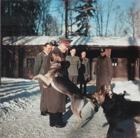
The Wolfschanze was the most famous and most used Führer Haupt Quartier of Hitler, who spent a lot of time there to coördinate the troops during the invasion of Russia. The Von Stauffenberg-
1. Bahnhof
2. Führerbunker
3. Göringbunker
4. Storch Airfield
5. Rastenburg Airfield

Wolfsschanze weergeven op een grotere kaart


Rastenburg Airfield (5)
Location: 54’02’39.42”N, 21’25’58.74”O
Today: Seems like it’s (remains) are still there.
There were two ways to get away from the Wolfsschanze by air. Next to the Wolfsschanze was a Storch Landing Field. South-


Bahnhof Görlitz (1)
Location: West of Sperrkreis I, in Sperrkreis II, between G
Today: Some remains of the station are still there.
When Hitler travelled by train he used this station. It was inside the Wolfsschanze area.


Storch Airfield (4)
Location: Directly next to the Wolfsschanze, on the north side, directly south of the railway
Today: Open field
There were two ways to get away from the Wolfsschanze by air. Next to the Wolfsschanze was a Storch Landing Field. South-

